The second big trip I took this last weekend was down to southern Indiana for the DINO Mission Adventure Race. What's an adventure race? That's an excellent question, especially since I myself didn't quite understand all that would be entailed until I was well in it.
An adventure race is a multi-segment race that uses a variety of transportation methods—in this one, foot, bicycle, and canoe. You don't know what's coming up in any of future segments, and even within a segment you don't know what challenges might be waiting for you at a checkpoint. All of the checkpoints within a segment are presented simply as map coordinates and you have to find them with a map and compass (use of a GPS is a disqualification). And it lasts 18 hours*.
Shaun, of course, was the instigator of getting us into this endeavor—DINO primarily runs mountain bike races in Indiana, which Shaun used to do and he's still on their mailing list. He and Andrea had previously done an urban adventure race—the Wild Scallion—and so he was able to rope her in as well to make us a 3-person coed team (which turned out to be the most common of all the divisions—10 of the 42 teams were "3C").
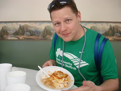
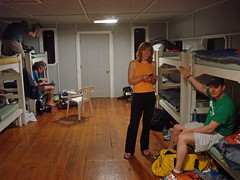
We drove down to Deleany Creek Park in southern Indiana on Friday night and, because we of course forgot the time change (and had some slightly wonky directions on how to get to the park—we wondered if it was our first test), barely got there in time to take a ropes refresher course, have a provided lasagna meal and race meeting, and then get our transition area set up. We tried to get to sleep early in the lodge we were sharing with 20 other racers, but we had forgotten how much noise turning over in a sleeping bag can make. And snoring. And the Mission Lite racers didn't need to be up until 8 am, so many of them stayed up until midnight. So it was a very restless night. We were up at 5 am, had some oatmeal (we felt very clever for bringing the fixings for a hot meal) and were off to the starting line.
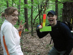
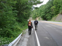
The first section was all on foot, orienteering to 6 check points. We were all fairly rusty with our map skills and so it took us awhile to get back into the swing of things and really use the UTM corner tool properly. Yes, yes, we should have practiced at home, but we're nothing if not bold foolish (and did I mention I'd just spent a week in Mississippi?). So we only got 2 of the 6 CPs in the four hours that were allotted for that segment.
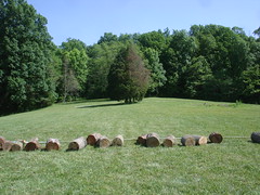
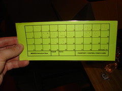
Then we were off on bikes. Our first bike challenge was a trick and a great reminder that we needed to stop and think at each decision point during the race. The map coordinates sent us to the top of a steep driveway in the camping area where we were greated with instructions to go 500 meters along a certain bearing. There were bikes scattered all around from people who had headed off into the woods on that bearing. We headed after them, but after fighting our way through 100 meters or so of scrub, I had the presence of mind to pull out the map and see where the end point of that bearing was. It was in the middle of a picnic area clearing, easily accessible from the camp road. So we headed back to our bikes, coasted down the hill, and completed an easy log carry challenge to get our cards punched.
We then headed out of the park, on what we assumed would be a long bike ride. But instead our checkpoint was just 5 miles away and was a parking lot with a semi trailer and bunch of canoes. We put our bikes in the semi and got in a canoe for our next segment.
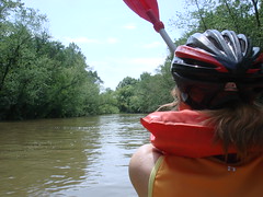
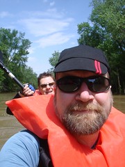
The canoeing segment was where we really realized just how tough the day was going to be. We started out by paddling upstream for a mile or so, to pick up a checkpoint under a bridge we had just biked over. It was hard work, but then we parked our canoes on the river bank and went for checkpoint 11.
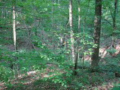
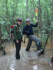
In the first orienteering section, the checkpoints had all been located on or in recognizable topographical features like re-entrants usually about 50 meters off a nice forest trail. Checkpoint 11 was located in the middle of a featureless, level section of small trees and vicious thorns and poison ivy, 500 meters from the shore. The actual checkpoint was located in the middle of a shallow, muddy pond. The only way to find the checkpoint was by dead reckoning. It was hard, muddy work, and our sense of accomplishment was enormous once we'd found the checkpoint. But what, we wondered, if it got a lot harder from here?
The rest of the segment proved to be fairly easy, just a bit of a slog. We canoed 10 miles or so, punctuated by two easily hiked-to checkpoints just off of roads. We did get rained on during that hike and it turned out later that our change of clothes back at the transition area were also getting rained on. Boo. I don't think I've ever been on a non-lazy canoe trip. Actively paddling for 10 miles is pretty wearing.
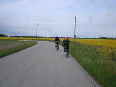
Then it was back on our bikes for a 14 mile bike ride along country roads. All the varied activities of the day meant that just when you were so exhausted you felt like you might collapse, it was on to a different activity that used different muscles and somehow we were able to go on.
Back in the park, the next segment was still on our bikes as we were back up on the same trails as the morning for bike orienteering. Andrea and I had never ridden on trails before, so it was pretty exciting for both of us. And then soon after we found our first checkpoint it began to get dark. We had heard from other racers that the next easily accesible checkpoint featured a rappel, so we pushed on in the dark to reach that. We'd been carrying our climbing gear all day, as required, and we didn't want that effort to go to waste.
By the time we reached the rappel, it was pitch dark. It was Andrea's first rappel and she'd been nervous about it all day, so we were proud of her that she tackled it in the dark and loved it. I was happy for the dark because the rappel probably would have been a little disappointing in the day (it was pretty short) but the dark added an air of danger.
We felt OK covering familar ground on bikes in the dark (by this time we'd been over that route several times on foot and bike) but uncomfortable pushing on into uncharted territory. We decided to accept the penalties for skipping the rest of the bike orienteering check points and head back to the transition area and move on to the next segment. In just a few hours Andrea and I went from never having ridden trails to riding on them lit only by headlamp. It was, I have to say, pretty fricking cool.
By the time we got back to the transition area, it was 11 pm, just an hour away from the midnight cutoff (the whole race is designed so that everyone is occupied for 18 hours—the winning team got 33 of 40 possible checkpoints—so there's a hard midnight cutoff). We looked at the next set of checkpoints which were all on foot in unfamilar territory on the south side of the park. We noticed that one was in an easily-discovered location on the south side of the lake and was noted as a manned station. We thought that might be something interesting that we could fit in in the last hour and so we headed that way. It turned out to be a zipline across a narrow part of the lake. Again in the pitch black! Wheee! We were the last riders of the zipline and then the volunteers packed up and we all headed back to the finish line.
We checked in at 17 hours and 56 minutes, grabbed the heroes' dinner awaiting us, and immediately collapsed into chairs while the winners in each category were announced. We were 35 of 42 overall and 7 of 10 in our category—a very good showing for first-time, unprepared us, I think.
All the way through the race we kept noting things we'd do better "next time". Whether we're really crazy enough to ever do this again remains to be seen.
* There was a 4 hour "Lite" Mission available. And, as always seems to happen with these extreme sports, someone has just done something even more extreme than what you're doing right now. One of the women running the Mission had just done a 36 hour adventure race in Norway.

